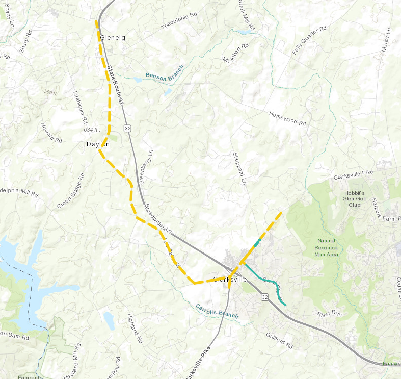
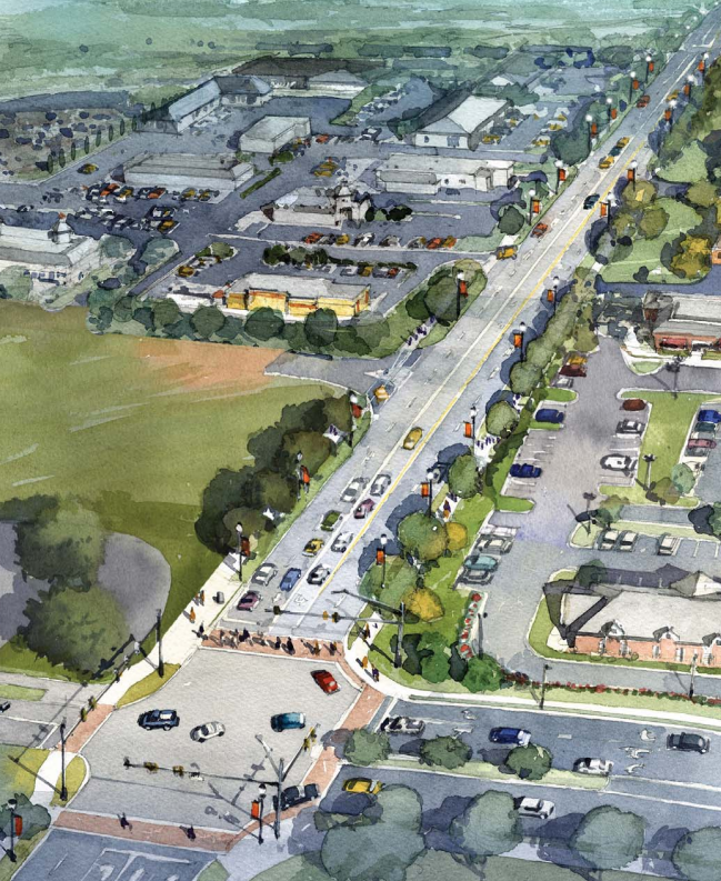
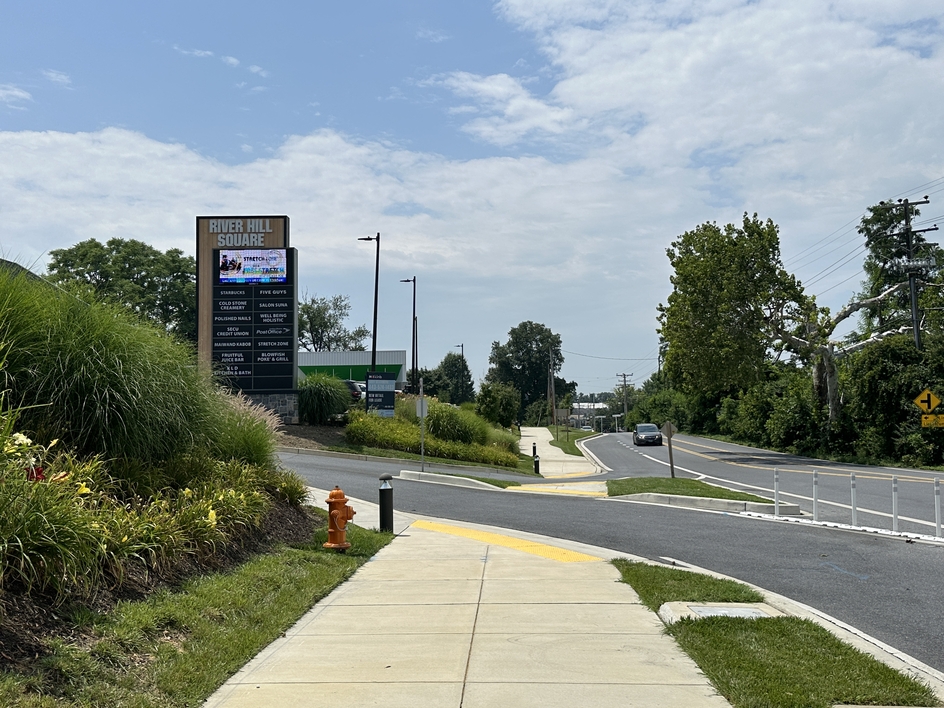
The Howard County Office of Transportation and Department of Public Works are advancing the Clarksville-River Hill Streetscape Improvements by developing plans for a system of shared use pathways, sidewalks, crosswalks, and bike lanes within Clarksville. The Clarksville-River Hill Streetscape Improvements projects, coupled with proposed and existing streetscape projects to be built by private sector development projects, will connect and link the commercial and residential uses along the Clarksville Pike (MD 108) corridor.
The interactive map depicts the different public and private sector project sections, which are in various stages of design, construction and completion. These sections closely match the sections articulated in the Clarksville-River Hill Streetscape Improvements, however, as the projects have evolved and changed, the extents section have changed and evolved as well.
Howard County is leveraging capital and grant funds to advance the design of the Clarksville-River Hill Streetscape Improvements: the Clarksville Streetscape; project and the MD 32 Alternate Bike Route Pinch Point 6 project. The MDOT Bikeways Network Grant was awarded in 2022 for the final design of shared use paths on Ten Oaks Road and Clarksville Pike (MD 108). The Maryland Kim Lamphier Bikeways Network Program provides grant assistance to local jurisdictions and other key agencies to help expedite the development of bicycle infrastructure where transportation efficiencies, multimodal travel, economic development, and safety benefits are expected.
RECENT PUBLIC OUTREACH EVENTS
MD 32 Alternate Bike Route Pinch Point 6 Open House Event
Howard County held an open house event on Thursday, November 2nd from 5:00 to 7:00 p.m. in the Media Room at River Hill High School in Clarksville, to present two ideas for multimodal travel improvements along Ten Oaks Road from Brighton Dam Road to MD 108.
Those who have questions or comments should contact Caitlin Kovel, PE of the Transportation & Special Projects Division at 410-313-6142 or email ckovel@howardcountymd.gov
The following materials were on display at the meeting:
Capital Project T7108 MD 32 Alternate Bike Route Pinch Point 6 Design Process
The MD 32 dualization project permanently removed bicycle access from MD 108 to I-70 by establishing through-highway access controls along the corridor between MD 108 and Burntwoods Road. To mitigate these impacts, MDOT SHA completed the MD 32 Bicycle Alternate Route Study to identify a viable and safe alternative bicycle route and associated infrastructure improvements that provide additional roadway space for cyclists and eliminate conflicts with automobile traffic.
MDOT SHA identified Ten Oaks Road as a potential replacement bicycle route for the MD 32 corridor. The following six pinch points (roadway segments that present challenges to a cyclist sharing the roadway with vehicles) were identified along Ten Oaks Road between MD 108 and Burntwoods Road:
-
Pinch Point 1 - West Side Between Rye River Drive & Oakwood Overlook Court
-
Pinch Point 2 - West Side Between Oakwood Overlook Court & Rutherford Way
-
Pinch Point 3 - Both Sides Between Dayton Oaks School and Green Bridge Road
-
Pinch Point 4 - Both Sides Between Green Bridge Road & Aerie Court
-
Pinch Point 5 - West Side Between Talon Court & Smallwood Court
-
Pinch Point 6 – Between Brighton Dam Road and MD 108
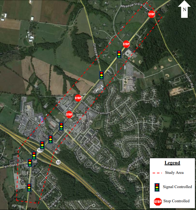
Pinch Points 1-5 are being implemented by MDOT SHA, whereas Howard County is undertaking the design and construction of Pinch Point 6. The southern section of Ten Oaks Road, between Brighton Dam Road and MD 108, has surrounding residential and commercial land uses that become more dense as you progress toward the MD 108 intersection. The roadway also widens as you approach MD 108, congestion is greater, and speeds increase compared to the northern section of the MD 32 alternate bike route corridor. As a result, the Pinch Point 6 project includes bike lanes and a shared use path to separate bicycle and vehicular traffic.
Capital Project T7108 Clarksville-River Hill Streetscape Improvements Design Process and Public Outreach
- Overview
- Preliminary Design (30%)
- Semi Final Design (60%)
- Final Design (100%)
- Past Public Outreach Events
Howard County is advancing recommendations from the Clarksville-River Hill Streetscape Improvements by developing plans for a system of shared-use pathways, sidewalks, and crosswalks on Clarksville Pike (MD 108) from Guilford Road to Great Star Drive.
Completed Projects and Studies
Multimodal Traffic Study & Preliminary Engineering
As part of the County’s goal to enhance pedestrian and bicycle access through the Clarksville Pike (MD 108) corridor, a multimodal traffic study was completed in 2015 to evaluate short-term complete street preliminary engineering concepts and develop refined long-term land use and traffic forecasts, roadway design elements and non-motorized network improvements. The study extended along Clarksville Pike (MD 108) from Guilford Road to Trotter Road.
The traffic study helped the County in its work with the MDOT State Highway Administration (MDOT SHA) to anticipate needed roadway improvements and was used to guide the development of the Clarksville/River Hill Streetscape Design Guidelines.
Clarksville Pike Multi-Modal Traffic Study and Preliminary Engineering
Clarksville Pike Multi-Modal Traffic Study-Appendix A Intersection Lanes and Photos
Clarksville Pike Multi-Modal Traffic Study-Appendix B Traffic Count Data
Clarksville Pike Multi-Modal Traffic Study-Appendix C Existing Cross Sections
Clarksville Pike Multi-Modal Traffic Study-Appendix F - Cost Estimate
Clarksville Pike Multi-Modal Traffic Study-Appendix G - Traffic Analysis Worksheets
Clarksville Parking Study
Howard County conducted a study of the parking lot located on the southeast corner of the MD 108 (Clarksville Pike) at Auto Drive/Signal Bell Lane intersection to identify existing and latent parking demand and evaluate options to provide additional parking. The study recommended maintaining the existing Park and Ride, and constructing a parking structure to provide additional parking spaces on the property.
To provide a comment, or for more information, call (410) 313-3842.