Interactive Map
Howard County's Interactive Map is your portal to all the geographic information you need about your property and neighborhood.
Check the checkbox near the appropriate layer to display information about parcel data, land use, easements, zoning, historic sites, and other categories.

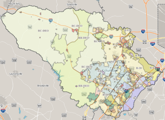
Find Your Zoning District
Howard County is divided into various zoning districts approved by the County Council. Each district has certain regulations that govern the development and use of land within the district. Use the interactive map to find your zoning district by entering your address, selecting your address from the adjacent menu, and then checking the "Planning & Zoning" category and the "Zoning" category.
Read the Zoning Regulations
Zoning Maps and Zoning Regulations serve to guide the proper growth and development of the County in accordance with the goals and policies of the General Plan. Once you find your zoning district, learn more about the zoning laws that apply to you in the County's zoning regulations.

Explore the Zoning Archives
View the Historic Zoning Map to access eight decades of past zoning maps that can be viewed together with historic aerial images. This application offers a comprehensive glimpse into the zoning history of Howard County, spanning from 1951 to the present day.