Introduction & Overview

Ellicott City and Oella, Maryland are historic places located on opposite sides of the Patapsco River. Historic Ellicott City’s Main Street, on the west side of the Patapsco River, is a retail and tourism destination, while Oella, on the east side of the Patapsco River, is connected to Catonsville and points east by the Number 9 Trolley Trail, a shared-use pathway that ends east of Oella Avenue.
The area has experienced numerous catastrophic flooding events, most recently in July 2016 and May 2018. Recent events have been “flash flood” scenarios, so Howard County undertook a Ellicott City Watershed Master Plan that encompassed stormwater management and drainage improvements throughout the Tiber/Hudson watershed as well as streetscape and green space improvements to the Main Street area. The purpose of this project is to further develop one particular plan recommendation—better bicycle and pedestrian accommodations across the Patapsco River—in a way that is compatible with the historic nature of the area as well as ongoing flood mitigation and planning efforts.
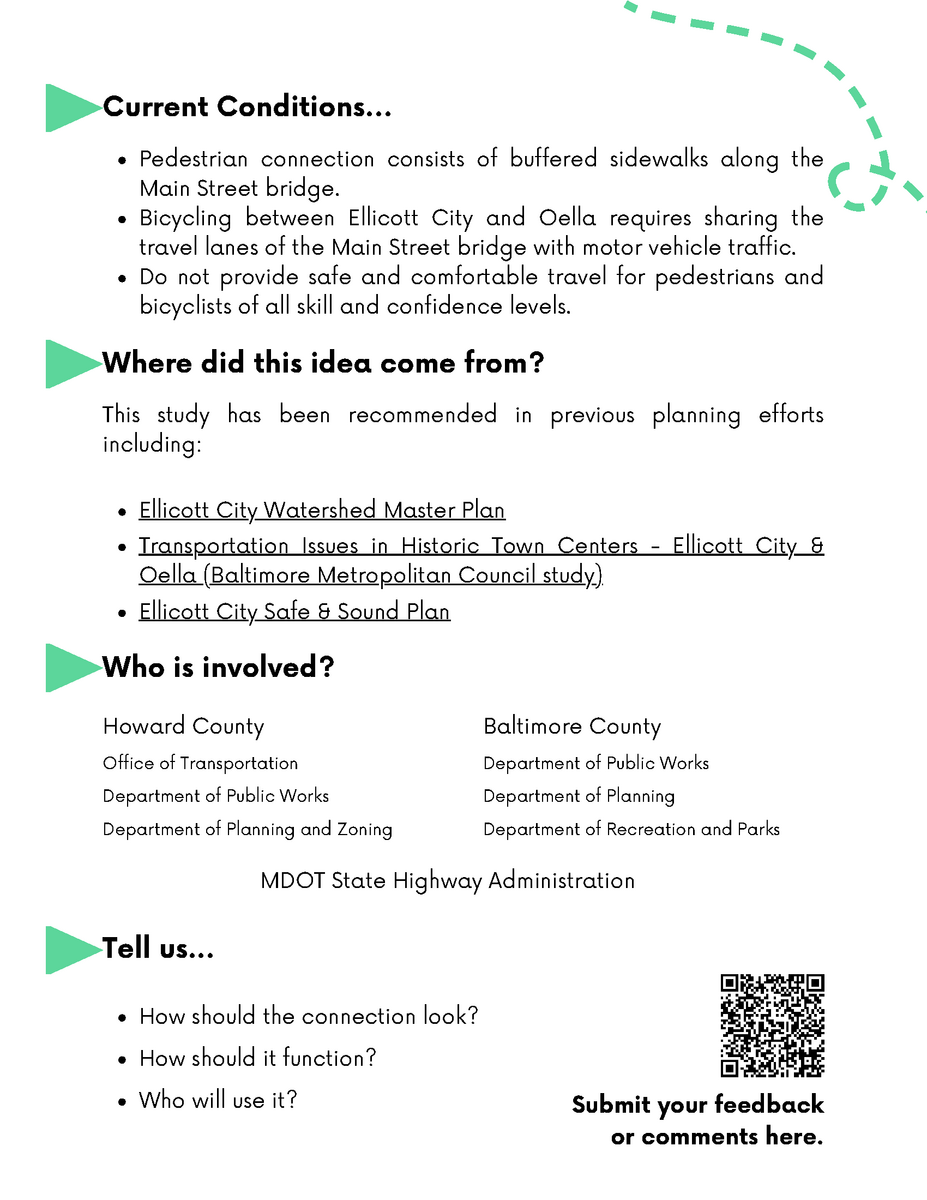
Currently, pedestrian connections between Oella and Ellicott City consist of buffered sidewalks along the Main Street bridge, while bicycling between the two places requires sharing the travel lanes of the Main Street bridge with motor vehicle traffic. This configuration does not provide safe and comfortable travel between Ellicott City and Oella for pedestrians and bicyclists of all skill and confidence levels. The Maryland Department of Transportation State Highway Administration (SHA) has therefore awarded Howard County, Maryland a Transportation Alternatives Program (TAP) grant to identify a way to provide better bicycle and pedestrian accommodations between Ellicott City and Oella.
A work group comprising the following agencies is currently undertaking this effort:
- Howard County Department of Public Works
- Howard County Office of Transportation
- Howard County Department of Planning and Zoning
- Baltimore County Department of Public Works
- Baltimore County Department of Planning
- Baltimore County Department of Recreation and Parks
- State Highway Administration
Final Report
The study has now concluded and the final Ellicott City - Oella Pedestrian Connections Feasibility Study report can be found below.
January Transportation Open House
The Office of Transportation, other County departments and offices, state and local agencies, and their partners held an Open House to learn more about the planning, design, operations, and maintenance of the County's transportation systems, including the results of this study! The work group was present to gather any feedback or comments about the study and its final alternatives at the Howard County Office of Transportation's Transportation Open House on January 30, 2023.
As a culmination of this project's efforts and an overview of the entire transportation network, this event and associated feedback will help orient the feasibility results for any future efforts as a result of this study.
| DATE | TIME | LOCATION |
|---|---|---|
January 30, 2024 |
04:30 PM - 07:30 PM |
Kenneth S. Ulman Innovation Hub/Gateway Building6751 Columbia Gateway Drive
|
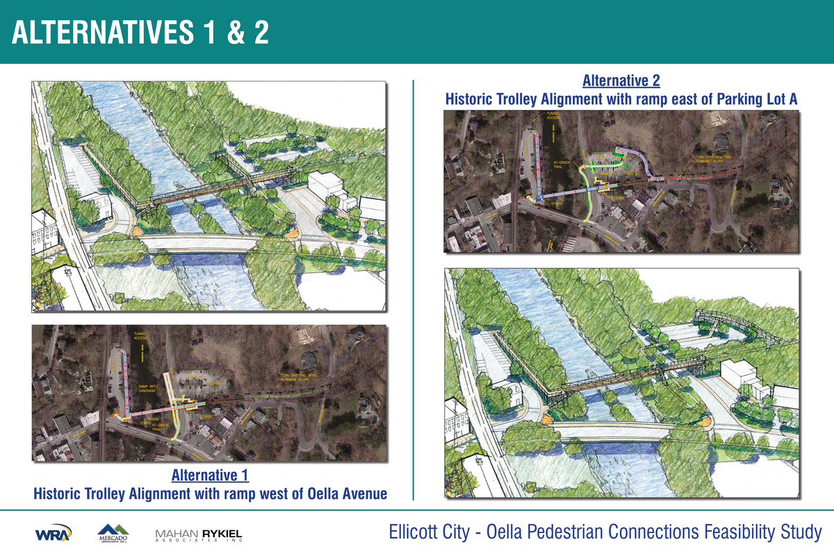
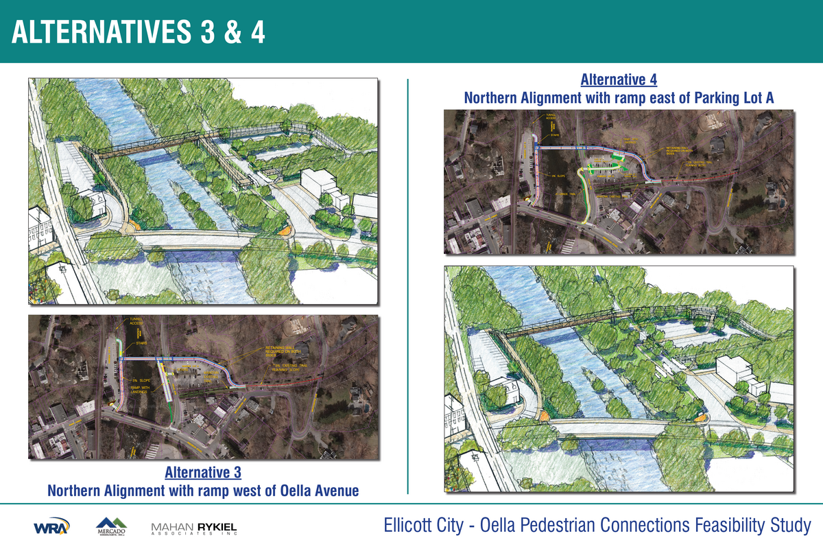
Study Alternatives
The alternatives found below were presented at the Transportation Open House on January 30, 2024.
We accepted comments and feedback on these alternatives throughout a three (3) week comment period.
The public comment period closed on February 20, 2024 at 11:59 p.m.
Study Alternatives

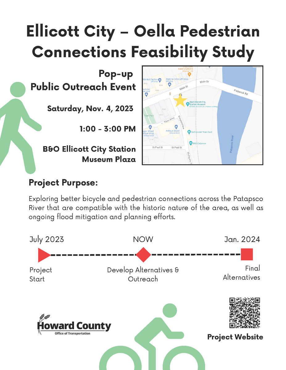
November 4, 2023 Pop-up Public Outreach Event
On November 4th, 2023, members of the work group held a pop-up public outreach event at the Ellicott City B&O Railroad Museum plaza to introduce the project to the public and gather any feedback to inform the development of alternatives. This public outreach builds upon the work already completed through the supplemental planning efforts that have informed this study.
In addition to an information flyer distributed by working group members, the materials presented at the event included a board providing an overview of the project, and another detailing the past planning efforts of the Ellicott City Watershed Master Plan and the Transportation in Historic Town Centers study. You may find those materials below.
Pop-up Event Materials

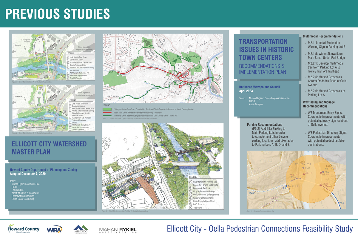
Supplemental Planning Efforts
- Ellicott City Watershed Master Plan
- Transportation Issues in Historic Town Centers - Ellicott City & Oella (Baltimore Metropolitan Council)
- Ellicott City Safe & Sound
- Patapsco Regional Greenway
The watershed master plan is a comprehensive, long-range document that creates a community-driven vision for historic Ellicott City and the Tiber Branch Watershed. The plan represents the culmination of a multi-year public outreach process that began in response to the 2016 flooding and builds upon County Executive Ball’s “Ellicott City Safe and Sound” flood mitigation plan. The adopted master plan establishes goals, desired outcomes and policies for the next twenty years. It also features conceptual illustrations that can serve as inspiration should specific opportunities arise over time.
To review and read the plan, click here.