About
The Vulnerable Watershed Restoration and Resiliency Program is an initiative aimed at identifying watersheds across Howard County that struggle with significant drainage issues and developing capital projects to address those issues.
The first step under this program is to identify the county’s Vulnerable Watersheds. Watersheds are considered vulnerable when:
- Any incremental increase in rainfall intensity may cause sudden inundation of the existing drainage system. The inundation could be caused by inadequate, missing or structurally failing infrastructure at the end of design life.
- Rain causes flood water to breach roadways making travel conditions hazardous and/or isolating parts of a community for a significant amount of time. Repeat heavy road damage commonly occurs and results in partial or full road closures lasting weeks to months.
- Rain causes flooding of primary residential or business structures potentially trapping occupants in structures requiring water rescues.
- Flood waters cause documented repeat damage to private or public properties other than primary properties.
- Drainage area is usually characterized by no or inadequate storm drainage (i.e., inlets, pipes, manholes, and outlets) and stormwater management (i.e., water quantity and/or water quality controls), but instead relies primarily on open swales to convey water directly to nearby streams.
- Primary structures are located within the 100-year floodplain.
- Residents in the affected areas may be disproportionately represented by historically vulnerable populations.
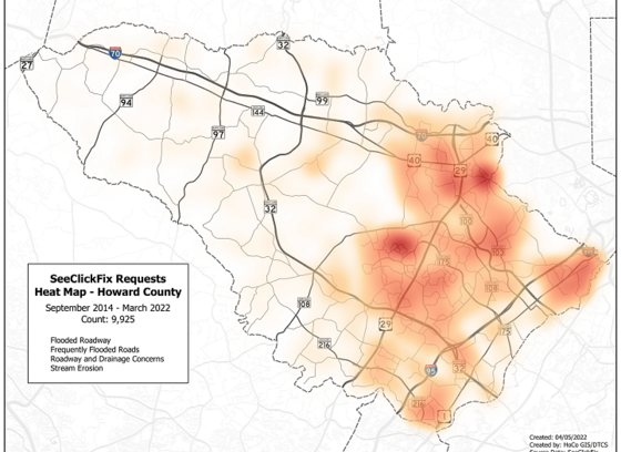
TellHoCo Map
This map shows the concentration of drainage complaints that the county has received through TellHoCo since its inception in September 2014 through March 2022. It is meant to be purely illustrative of areas in the county where residents have reported drainage issues, which are primarily in the eastern portion of the county, and does not indicate watersheds that have been identified in the Vulnerable Watersheds program.
Once a watershed has been determined to be vulnerable, the County will undertake a comprehensive analysis of the watershed or drainage area, including an evaluation of any existing storm drainage and/or stormwater controls under the design storm criteria. The comprehensive analysis will then prescribe breakout projects within the drainage area that will better manage stormwater, improve flood conditions, and create a more resilient neighborhood. It is important to note that due to topography, property ownership, existing infrastructure, and other challenges such as funding priorities, not every assessment will lead to a capital project.
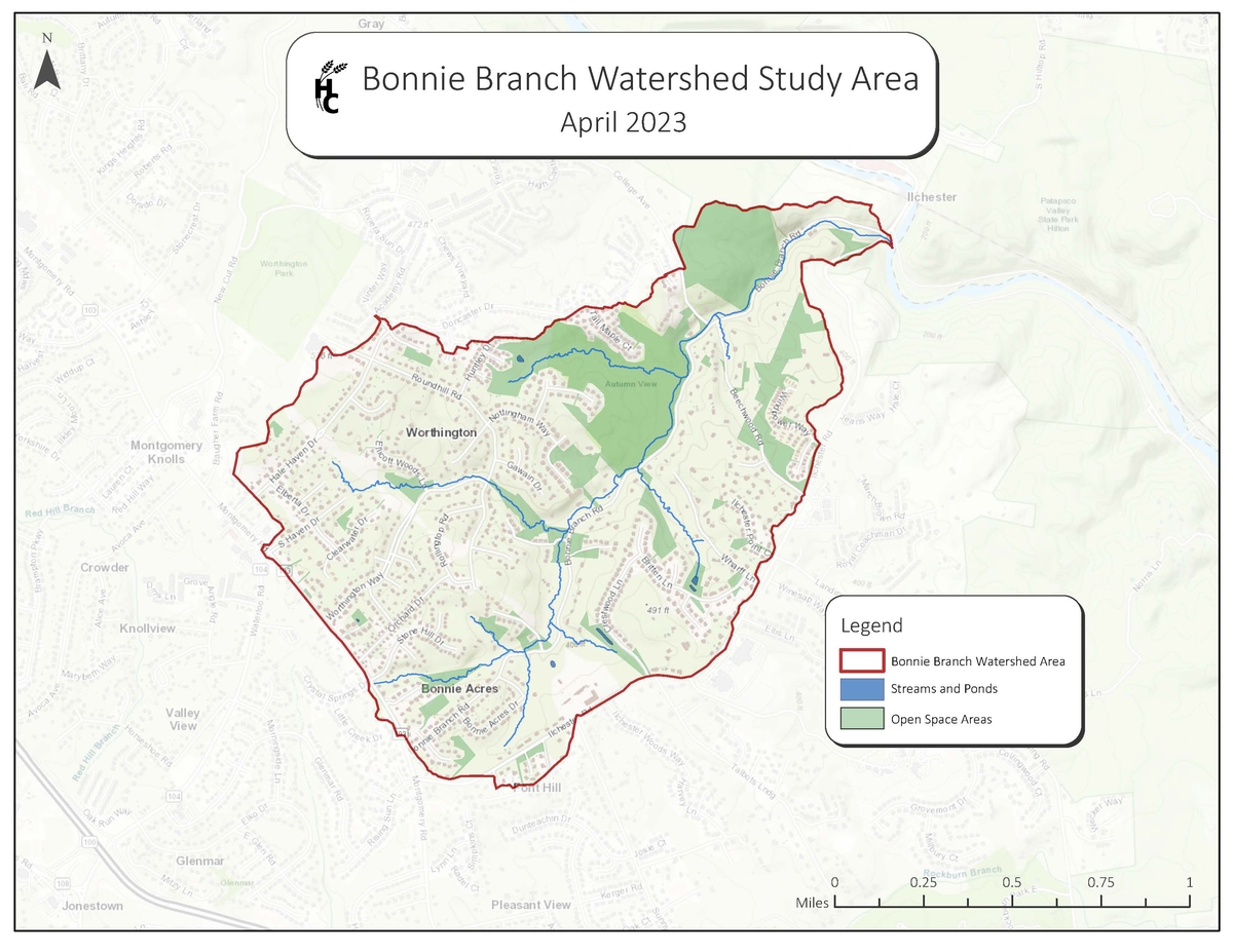
Bonnie Branch Watershed Study
The first study for the Vulnerable Watershed Restoration and Resiliency Program is taking place in the Bonnie Branch Watershed in the area adjacent to Bonnie Branch Road.
The study will assess:
- Opportunities for water quality improvement and flood resiliency
- Opportunities for improved stormwater infrastructure and management
- Existing stormwater infrastructure (ponds, inlets, pipes, manholes, outlets, swales)
The study will be complete in Spring/Summer 2025.
Download the Bonnie Branch Watershed Study Area Map. This is a color map of the Bonnie Branch Watershed Study Area roughly bounded by the Patapsco River to the north, Ilchester Road to the east, Montgomery Road (MD-103) to the south, and Hale Haven Road to the west. Building locations, streams, road names, neighborhood names, and open space are shown on the county base map.