The project was installed on Monday, August 12, 2024 and removed on Monday, November 25, 2024.
Introduction & Overview
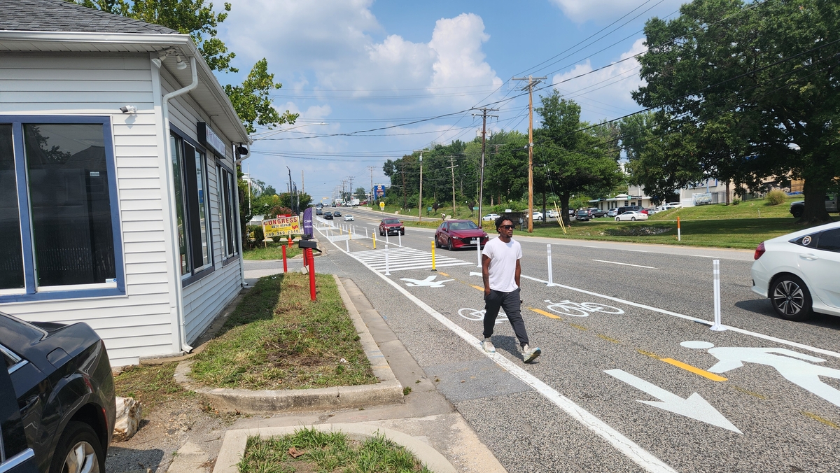
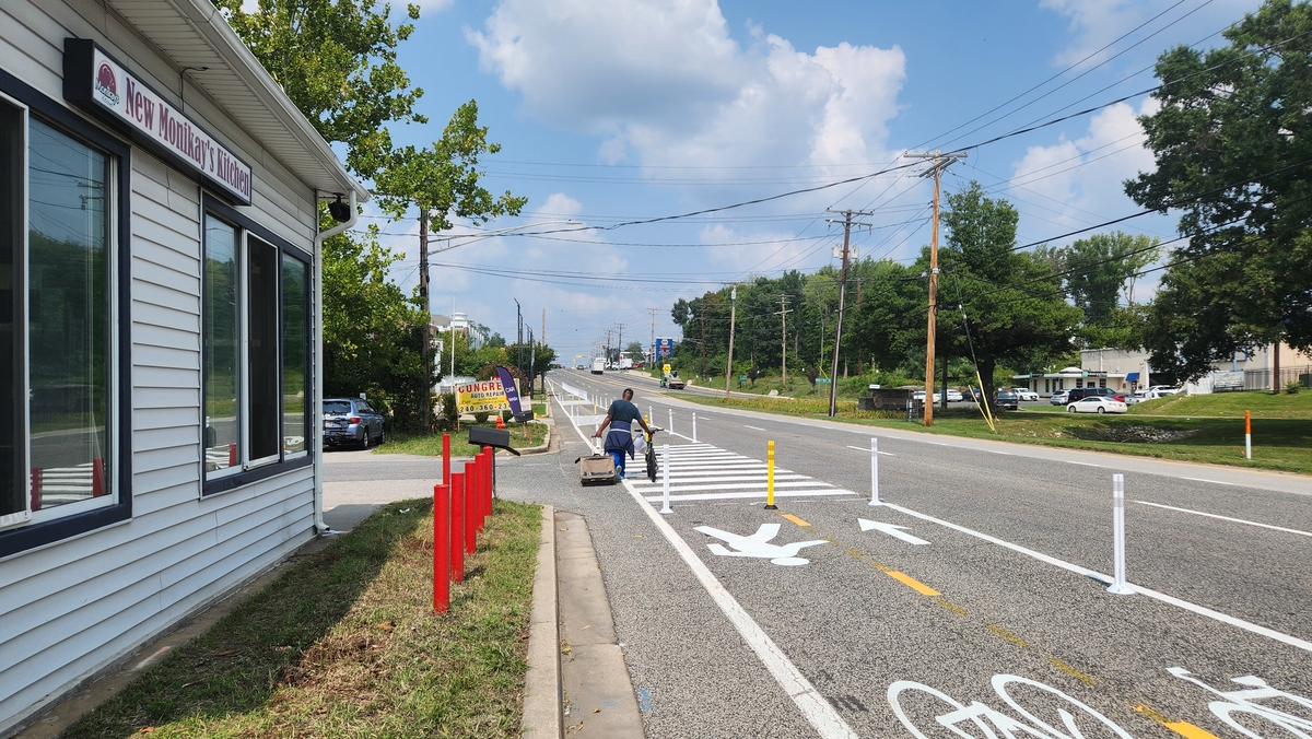
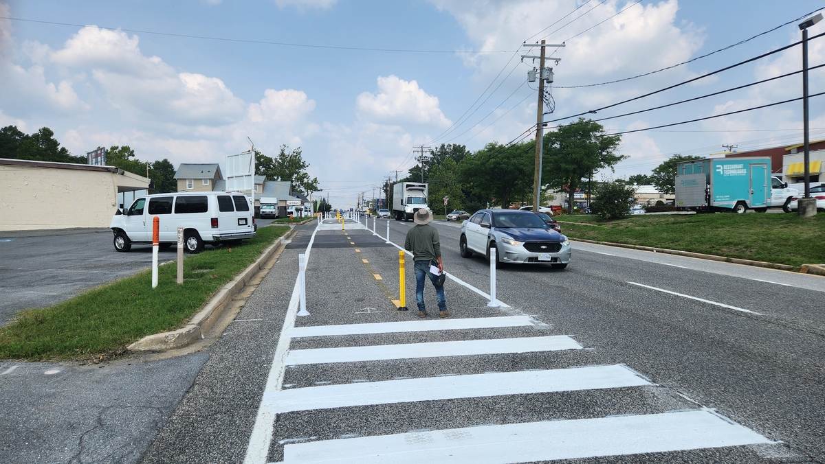
The Howard County Office of Transportation and Department of Public Works partnered with Smart Growth America and the State Highway Administration on a Complete Streets Leadership Academies project on US 1 in North Laurel.
Smart Growth America (SGA), with support from CDC’s Active People, Healthy Nation initiative, launched the Complete Streets Leadership Academies to equip and train local agencies and state departments of transportation to collaborate, innovate, and commit to making changes together to address safety on these dangerous state-owned roads. Cohorts were selected to plan and implement “quick-build” demonstration projects, a way to pilot and test new ideas and street designs to activate streets and better support walking, biking, and rolling.
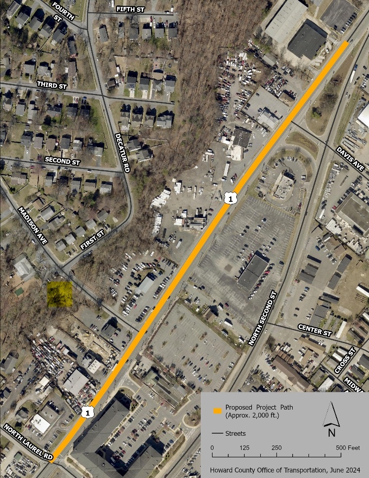
A section of US 1 in North Laurel, Howard County was chosen as one of three areas for the first cohort in Maryland.
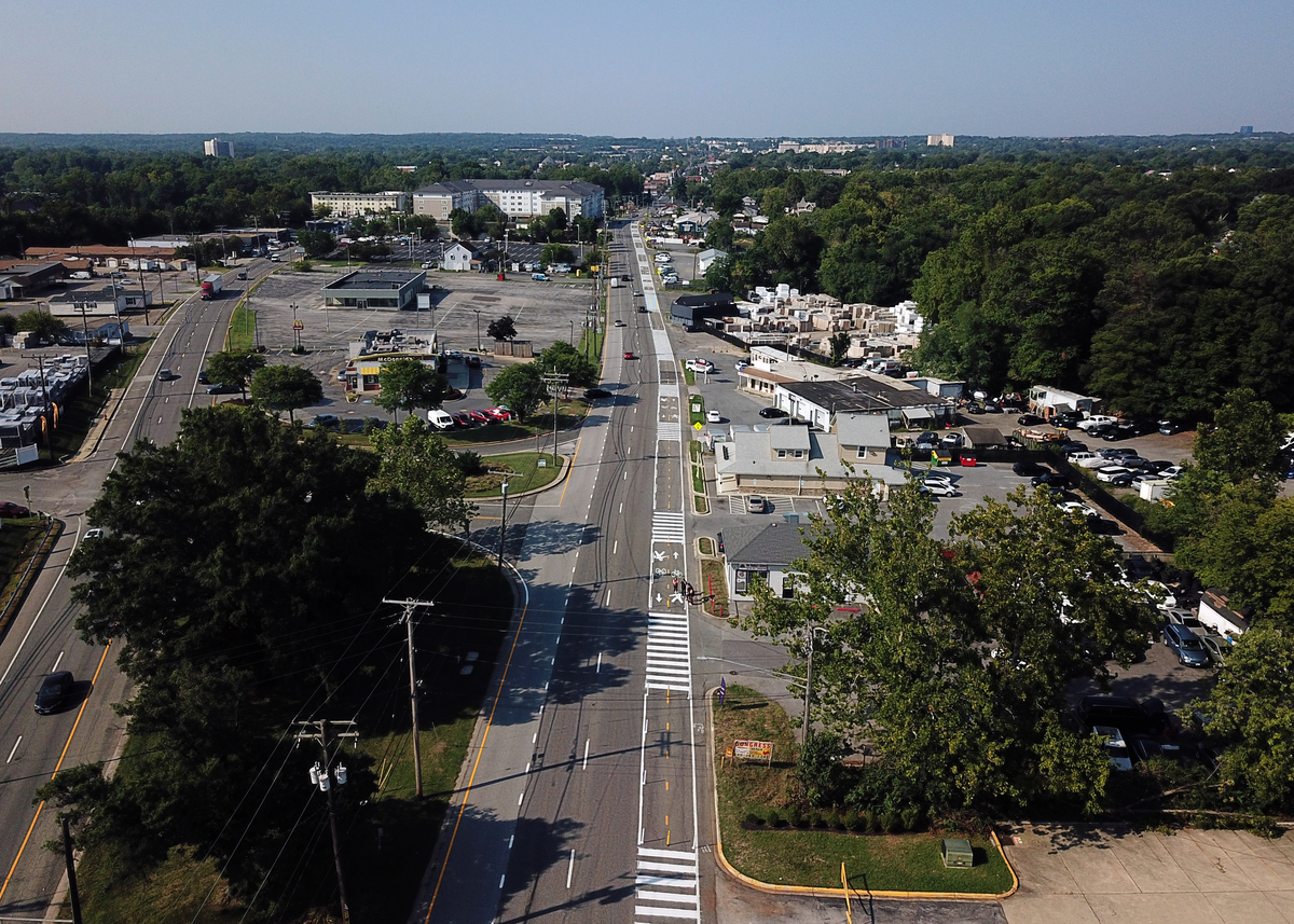
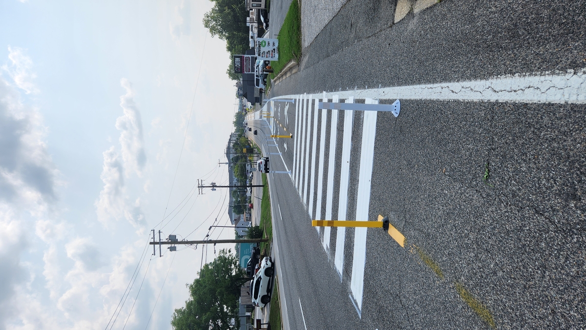
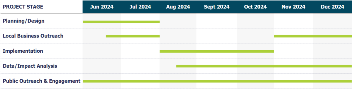
Howard County working with the State Highway Administration and Smart Growth America to implement this quick-build demonstration project. The project was installed on Monday, August 12, 2024 and removed on Monday November 25, 2024. The project was studied for its effects on the safety and well-being of pedestrians, bicyclists, and other vulnerable road users along the corridor over the duration of the project period. The phases of the project were:
- Design/Engineering/Construction
- Public Outreach & Engagement
- Data Collection/Analysis
Project Goals
The team has identified the following project goals to help guide this effort:
-
Improve safety for existing pedestrians and cyclists
-
Encourage more walking and biking
-
Reduce motor vehicle speeds
-
Maintain access to businesses
These goals align with Howard County's transportation safety goals set out through our Strategic Roadway Safety Plan, implementation of our award-winning Complete Streets Policy, and the policies and actions described in the County's general plan, HoCo By Design.
Project Information
Project Timeline
Background Data
Before & after data for traffic volumes, traffic speeds, and bike/pedestrian volumes will be collected to analyze the impact of the "quick-build" demonstration improvements.
The following is baseline data to understand the need for these safety improvements and general context of the roadway and built environment.
2024 Traffic Volumes:
| AM Peak | PM Peak |
|---|---|
| 1,125 | 1,498 |
US 1 (Southbound) Speed Data:
| Posted Speed | Average | 85th Percentile | Highest |
|---|---|---|---|
| 35 mph | 44 mph | 50 mph | 58 mph |
2024 Bicycle & Pedestrian Volumes:
| Midblock | US 1 (Southbound) at N. Laurel Rd. |
|---|---|
| 36 | (See diagram below) |

2017 Bicycle and Pedestrian Counts:
| Pedestrians | Bicyclists |
|---|---|
| 22 | 7 |
| Pedestrians | Bicyclists |
|---|---|
| 84 | 8 |
Safety Data
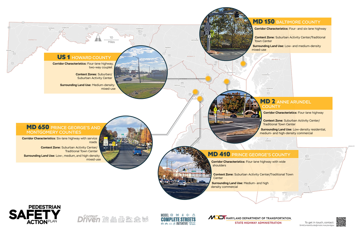
The selection of US 1 for this project is backed by empirical data demonstrating the safety concerns along the entire corridor. This is highlighted by the inclusion of US 1 in both Howard County's High-Injury Network and the MDOT State Highway Administration's Pedestrian Safety Action Plan (PSAP) focusing on vulnerable road users.
MDOT SHA's Pedestrian Safety Action Plan (PSAP) employs a data-driven approach to identifying specific areas of need and prioritizing those corridors where safety and access needs are most prevalent. It is a new tool in the agency’s ongoing efforts to enhance pedestrian and bicycle safety and mobility, and improve multi-modal access for communities across the state.

Public Outreach & Engagement
Public outreach and engagement with the local community – in addition to road users travelling up and down the corridor – is crucial to the success of this effort. Understanding the impact that these changes demonstrate to the safety of all is just another way to gather important pieces of data to aid our understanding of this initiative's success. This will be ongoing throughout the entirety of this project and carried out in many different ways, including those highlighted below.
Engagement with Road Users
- Variable message boards along the corridor
- County social media
- Feedback form on project webpage
Engagement with Local Businesses
Conducted through targeted outreach and canvassing before and after project installation.
- Before: Driveway access discussion
- After: Impact on business
Feedback or Comments?
Click the button below to access the comment form and provide any feedback you may have about the project.