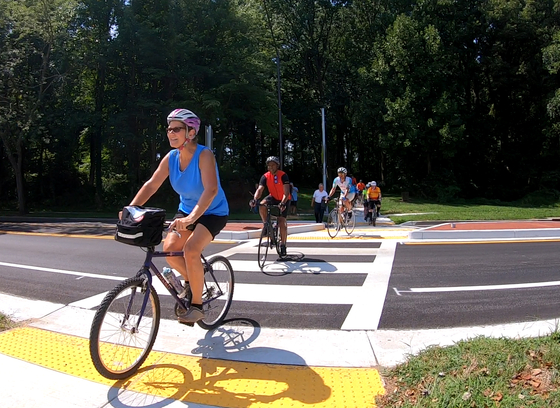
Active Transportation
Master Planning
The Office of Transportation develops and implements master plans for pedestrian and bicycle transportation through different programs and projects.
WalkHoward
WalkHoward is Howard County's pedestrian master plan and was adopted in February 2020 through Council Resolution 14-2020. This master plan addresses walking in all of its forms – whether you are trying to get somewhere or just taking a casual stroll somewhere you love.
- Visit WalkHoward
BikeHoward
BikeHoward, the Howard County bicycle master plan, was adopted by the County Council in 2016. The plan provides guidance for improvements for transportation and recreational bicycling, both on-street and off-street. Recommendations are provided in the general areas of infrastructure improvements, policy and programs.
- Visit BikeHoward
Open Houses
Transportation Open House (2024-Present)
Beginning in 2024, the Active Transportation Open House was expanded into the Transportation Open House, an all-encompassing event showcasing the County's transportation efforts across numerous topic areas. Though the event's scope has grown, active transportation remains a major focus of the Transportation Open House.
Click on the link below to see a summary of information presented at the first annual Howard County Transportation Open House.
Active Transportation Open House (2021-2023)
From 2021-2023, the Office of Transportation hosted an annual Active Transportation Open House to highlight the County's bicycle, pedestrian, and electric scooter efforts.
Click on the links below to view information presented at the Office of Transportation's Active Transportation Open Houses.
Active Transportation Open House 2023
BikeHoward Open House (2017-2020)
Click on the links below to see a summary of information presented at the Office of Transportation's former BikeHoward open houses.
Programs
Complete Streets
Howard County Council Resolution 35-2016 requires the County to develop a Complete Streets Policy and Design Manual updates in accordance with the following policy intention statement:
“To ensure that Howard County is a place for individuals of all backgrounds to live and travel freely, safely, and comfortably, public and private roadways in Howard County shall be safe and convenient for residents of all ages and abilities who travel by foot, bicycle, public transportation or automobile, ensuring sustainable communities Countywide.”
Howard County Bikeshare operated from July 2017 through February 2022.
For more information, please visit the program webpage.
The Howard County Office of Transportation oversees the permitting process for shared electric scooters. The first permit was granted for the period from March 23, 2022 to March 22, 2023. Spin was awarded the permit and operated a six-month pilot program from June 3 to November 20, 2022. In 2023 and 2024, no vendors applied for a permit to operate shared electric scooters in Howard County.
For more information, please visit the program webpage.
Current Implementation Projects
Bicycle and Pedestrian Counting Program
Howard County, in partnership with Columbia Association (CA), will install permanent bicycle and pedestrian counters at two locations in Columbia: at Lake Elkhorn and at the bicycle/pedestrian bridge over US 29. These counters will allow Howard County and CA to monitor seasonal and long-term trends of walking and bicycling in central Howard County.
Bike Lanes Via Resurfacing
Howard County frequently implements recommendations in the Bicycle Master Plan when a roadway is being resurfaced to maximize cost efficiency.
Bike Wayfinding
Howard County is conducting a county-wide bicycle network study to improve bicycle wayfinding signage. The goal of this project is to help people to better understand and use Howard County’s bicycle network and make create easy connections with destinations.
Cedar Lane Pathway
Howard County will construct a shared-use pathway on the west side of Cedar Lane between Little Patuxent Parkway and Harper's Farm Road. Plans are complete, and property acquisition is ongoing in advance of construction. For more information, see the project page.
Clarksville Pike Streetscape Plan and Design Guidelines
Shared-Use Pathway 30% Design
For more information about the shared-use pathway 30% design project, please visit the project page.
Traffic Study
Public comments related to the traffic study are welcome. However, traffic studies are for informational purposes, and they are not adopted as policy by the County. The traffic study also serves to help the County in its work with State Highway Administration to anticipate needed roadway improvements.
Clarksville Pike Multi-Modal Traffic Study and Preliminary Engineering.pdf
Clarksville Pike Multi-Modal Traffic Study-Appendix A Intersection Lanes and Photos.pdf
Clarksville Pike Multi-Modal Traffic Study-Appendix B Traffic Count Data.pdf
Clarksville Pike Multi-Modal Traffic Study-Appendix C Existing Cross Sections.pdf
Clarksville Pike Multi-Modal Traffic Study-Appendix F - Cost Estimate.pdf
Clarksville Pike Multi-Modal Traffic Study-Appendix G - Traffic Analysis Worksheets.pdf
Complete Streets Corridor Studies
The Office of Transportation is conducting three intermediate planning projects in 2018-19 to assess the needs and opportunities for complete streets improvements along three roadways in Howard County. The three roadways are:
- Oakland Mills Road from Old Montgomery Road to Snowden RIver Parkway
- Tamar Drive from Flamepool Way to Snowden River Parkway
- Columbia Road from Old Annapolis Road to ¼ mile east of Hemlock Cone Way
In conjunction with the Columbia Road complete streets planning project, the Office of Transportation is assessing current traffic operations along Columbia Road between MD 108 and Old Annapolis Road.
Howard County has received a Transportation Alternatives grant to finalize design of a shared-use pathway along Dobbin Road from Oakland Mills Road to McGaw Road, and along McGaw Road from Dobbin Road to Stanford Boulevard, along with associated sidewalk and intersection improvements. For more information, see the project page.
Ellicott City/Oella Bridge
Howard County has received a Transportation Alternatives grant for a feasibility study for a pedestrian bridge from Trolley Line No.9 trail across the river to Ellicott City. This project will be coordinated with the Ellicott City master plan.
Hickory Ridge Bike Corridor
The Hickory Ridge Bike Corridor study is a technical assessment of BikeHoward recommendations in and near Hickory Ridge. The goal is to develop a preferred route for continuous bicycle facilities to connect existing bike lanes on Grace Drive (providing access from River Hill and points west) to Hickory Ridge, Downtown Columbia and the rest of the Columbia pathway system and bike network.
Hickory Ridge Pathway Project
This project includes the design and construction of shared-use pathway connections at the intersection of Hickory Ridge Road and Broken Land Parkway. A study was completed in 2020 to investigate multimodal connection opportunities between the Village of River Hill, Village of Hickory Ridge, and Downtown Columbia. This project will be derived from a some of the proposed improvements established in the 2020 corridor plan.
For more information, please visit the project webpage.
Montgomery Road Pedestrian & Bicycle Facility Feasibility Study
The purpose of this study is to develop and evaluate the feasibility of providing pedestrian and bicycle facilities along Montgomery Road between Deborah Jean Drive and Rowanberry Drive. The study will seek to implement the County’s Complete Streets Design Manual in this area.
For more information, please visit the project webpage.
North Laurel Connections
The goal of this project is to develop an enhanced bicycle connection from the Patuxent Branch Trail trailhead at Savage Park to the North Laurel Community Center continuing to the Laurel Race Track MARC Station and the Laurel MARC Station, potentially including a shared use pathway to improve access and connections across an existing utility right of way.
For more information, please visit the project webpage.
Old Scaggsville Road Pedestrian & Bicycle Facility Feasibility Study
The purpose of this study is to develop and evaluate the feasibility of providing pedestrian and bicycle facilities in the North Laurel Area of the County. Specifically, the study's extent will include the stretch of Old Scaggsville Road from Superior Ave to High Ridge Park. The study will seek to implement the County’s Complete Streets Design Manual in this area.
For more information, please visit the project webpage.
Patuxent Branch Trail Surface Upgrade
Howard County received a Transportation Alternatives grant to upgrade the surface of the Patuxent Branch Trail between the Patuxent Branch trailhead at Old Guilford Road and Vollmerhausen Road in Savage. This project is needed to alleviate existing poor drainage, ensure compliance with Americans with Disabilities Act (ADA) standards, and complete a critical connectivity link as part of a regional bicycle and pedestrian network between Downtown Columbia, Savage and Laurel.
For more information, see the project page.
Robert Fulton Drive Pathway Project
The Howard County Office of Transportation is conducting a planning study and preliminary design for a shared-use (pedestrian and bicycle) pathway along Robert Fulton Drive.
South Entrance Trail
The South Entrance Trail (formerly known as the Downtown Columbia to Stevens Forest Road Pathway) would connect the growing shared-use pathway network in Downtown Columbia to Hillcroft Executive Park, Owen Brown, Lake Elkhorn, and the Patuxent Branch Trail. The 1.3-mile pathway would generally follow an existing sewer alignment along the Little Patuxent River.
For more information, see the project page.
US 1 Safety
In 2017-18, Howard County undertook a US 1 Safety Evaluation in response to a significant increase in the number of pedestrian fatalities along US 1 in 2015 and 2016 and in light of increasing residential and mixed-use development in this historically commercial and industrial corridor. Howard County is now moving forward with implementation of some of the Evaluation's recommendations in partnership with the Maryland Department of Transportation State Highway Administration.
Completed Implementation Projects
BikeHoward Express
BikeHoward Express is Howard County's accelerated 3-year implementation plan for bicycle infrastructure in Howard County.
Howard Community College Connector
This project will create a north-south connection, via a combination of a new shared-use path, paving, and sharrows, between Hickory Ridge Road and Little Patuxent Parkway via Howard Community College. This connection is identified by both BikeHoward and Howard Community College’s Facilities Master Plan, and will not only improve bicycle and pedestrian access to the College but also link with existing pathways to create a new bicycle and pedestrian route between Hickory Ridge and the Downtown Columbia Trail.
For more information, see the project page.
Patuxent Branch Trail Improvements
The Department of Recreation and Parks has constructed a trail connection adjacent to Old Guilford Road between the Guilford Pratt Truss Bridge and the Patuxent Branch Trail to Lake Elkhorn. This project increases safety for people walking, jogging, and bicycling along Old Guilford Road, and contribute to the goal of a connected pathway between Columbia and Savage.
