Resources for Residents and Property Owners
Have a question about your property or neighborhood?
Find information about your zoning district, your property, and development projects in your area:

Need More Help? Contact the Planner of the Day
Need to speak with someone about your question?
Contact the Department's Planner of the Day.
Call
410-313-2350
Email
Planning@HowardCountyMD.gov
Visit
1st Floor George Howard Building
3430 Court House Drive
Ellicott City, MD 21043
Monday - Thursday: 8:00 am to 5:00 pm
Friday: 8:00 am to 3:00 pm

Frequently Asked Questions: Zoning
How do I determine the zoning of a property?
You can determine the zoning of your property by using the Interactive Map here. Select “Planning and Zoning” from the menu of the left and then click “Zoning.” You can change the opacity by selecting the down arrow on the right side of the “Zoning” tab. You can also access eight decades of past zoning maps here that can be viewed together with historic aerial images.
How do I determine which uses are permitted on a property?
The zoning district in which the property is located determines the permitted uses. Each zoning district contains primary uses, accessory uses, and conditional uses. Any use not listed as permitted is prohibited. The Zoning Regulations can be found here. Scroll down the table of contents on the left to find your zoning district and click on the section.
Primary or principal uses are those uses permitted as a matter of right in the specific zoning district.
Accessory uses are uses normally and customarily incidental and subordinate to a primary use and may be permitted by right or require a permit from the Department of Planning and Zoning as required in Section 128.0 of the Zoning Regulations.
Conditional uses (formerly called special exceptions) are land uses and activities that require approval by the Hearing Authority for a specific location, based upon criteria established in the Zoning Regulations. The uses, criteria, and process are found in Sec. 131.0 of the Zoning Regulations.
How do I submit a zoning petition (variance, conditional use, or nonconforming use)?
All zoning petitions are initiated by completing the appropriate form. Specific instructions are found on the form and additional petition information can be found here.
How do I find out more information about conditional uses?
For information about the Conditional Use Process, click here.
Cases regarding conditional uses are handled by the Hearing Examiner. For more information about the Hearing Examiner, click here.
How do I determine the setback and height restrictions (known as Bulk Regulations) for a property?
Structures, as defined in Section 103.0, must comply with the applicable setback and height limits listed in the bulk requirements section of the specific zoning district in which the property is located.
Each zoning district has setbacks for principal structures, accessory structures, and uses (other than structures) such as parking. Structures attached to the principal structure must meet the principal structure setbacks. Structures detached from the principal structure must meet the accessory structure setbacks and maximum lot coverage requirements of the zoning district and Section 128.0.A, where applicable.
How do I find out if there are any open zoning/subdivision violations on a property?
To determine if a property has any open violations, you will need to file a Public Information Act (PIA) request to the County. Find more information here.
How do I check on the status of my permit?
Permit reviews are coordinated through the Department of Inspections, Licenses and Permits (DILP). You can access permit information online at the Accela Citizen Portal or by phone at 410-313-2455.
How do I submit a zoning violation complaint?
Code enforcement is complaint-driven. We rely on citizens to bring issues to our attention and work with the Department as necessary. Find more information about submitting a zoning violation complaint here.
Where can I put up a shed, garage, deck, or fence on my property?
When constructing additions to your property, the required setbacks from your property line will often depend on a number of situations which can found in the Zoning Code. If you have difficulty interpreting the code, please call the Department's Planner of the Day at 410-313-2350 for assistance.
I saw a public notice sign posted on a property. What does it mean?
A yellow sign refers to a Department of Public Works capital project.
Public notice signs that are blue (pre-submission meetings), red (public meeting/hearing), or black and white (public notice sign) are posted by the Department of Planning & Zoning to provide notification to the public about public or private development projects. Enter the three alphanumeric characters (example: Z88) to find project information on the Search Development Plans website.
What is my fee?
Fees are based on specific plan submissions and applications. For a complete list of approved fees, click here.
How do I pay a fee?
Fees can be paid at the Department of Finance Cashier’s Office at 3430 Court House Drive. Be sure to first obtain a receipt from the Department of Planning & Zoning before proceeding to the Department of Finance.
Please make checks payable to the "Director of Finance." Please be advised that the cashier's office does not accept credit or debit cards at this time.
Frequently Asked Questions: Property Development
Can my property be developed?
Multiple factors such as zoning designation, availability of utilities, and property history determine whether the Department of Planning and Zoning recognizes your property as a buildable lot. Call the Department's Planner of the Day at 410-313-2350 for assistance with determining if your lot has the potential to built on.
Can I subdivide my property?
Multiple factors such as zoning designation, growth tier designation, and property history determine whether your property has subdivision potential. Call the Department's Planner of the Day at 410-313-2350 for assistance with determining subdivision potential.
Where can I find the approved site development plan, final development plan, or subdivision plat for my property?
You can find the approved plans for a property by using the Department's Interactive Map.
Select “Planning and Zoning” from the menu of the left and click “Scanned Drawings.” Then, enter your address in the search box at the upper left. You do not need to include street name suffixes (Avenue, Street, Lane, etc.).
Then, click on the property to display the “Info Tool” box, which contains links to PDFs of the approved plans.
For a step by step guide on locating approved plans, click here.
How do I check on the status of my plan review?
Each development plan is assigned a staff planner who manages the plan through the development process. The staff planner is listed on the Search Development Plans application for the specific project. Or you may contact the Department's Planner of the Day at 410-313-2530 for a status of the plan review.
What is the process for submitting a development plan or alternative compliance request?
Development Plans are submitted through the Department’s ProjectDox electronic plan review system. More information on ProjectDox and the application requirements can be found here.
Alternative Compliance requests are submitted by paper application to the Division of Land Development (DLD). Physical plan submissions can be mailed to Howard County Planning and Zoning, 3430 Court House Drive, Ellicott City, MD 21043 or dropped into the bin labeled ‘DLD’ in the George Howard Building lobby. More information on the Alternative Compliance application requirements can be found here.
I am buying a parcel. How do I determine how much it is going to cost to develop it?
There are multiple steps in the development review process where the Department of Planning and Zoning may assess a development review fee. Information on Planning and Zoning review fees can be found here. Most development projects are required to be prepared by a professional designer who will assess separate private fees for their service.
The Department of Inspections, Licenses and Permits will also assess fees associated with the review and issuance of grading and building permits. Information on the permit fees can be found here.
I have an easement recorded on my property. What is an easement and what restrictions are imposed with the easement?
An easement is the right to use someone’s property for a specific purpose or to restrict specific uses or activities on the property. Easements can be public or private. Structures and certain uses may not be permitted within an easement, depending upon the conditions of each easement and the need for easement holder permission.
Some examples of easements include the following:
- Water, sewer, and utility easements
- Drainage easements
- Access or use-in-common driveway easements
- Forest conservation easements
- Preservation parcel easements
- Tree maintenance easements
How can I find information for a current project?
The Search Plans database allows you to find historic and current development plans. Whether you saw a notification sign, heard about a pre-submission meeting, or are interested in information regarding an ongoing project or proposed development near a specific address, this tool can help to find project information.
Open map and database on the Search Development Plans page. Read the disclaimer and click on “I Agree" to use the map.
Then, in the search menu, click on the “Sign Code” button.
Input the sign code for the fiscal year. Click on the Public Hearing Notice to view more information
Note: Sign codes are always 3 characters: a letter that corresponds to the type of public hearing or type of development requiring a presubmission community meeting, followed by two numbers.
Public Hearing Notice:
B 01-99: Board of Appeals
D 01-99: Administrative Adjustments, Temporary Uses, Non-Conforming Uses
H 01-99: Hearing Examiner
P 01-99: Planning Board
Z 01-99: Zoning Board
Presubmission Community Meeting:
C 01-99: Conditional Use R 01-99: Residential Development
M 01-99: Zoning Map Amendment Request
N 01-99: Non-Residential Development
V 01-99: Columbia Village Redevelopment
T 01-99: Downtown Columbia
How do I get a copy of architectural or structural drawings?
The Department of Planning and Zoning maintains files of site development plans, which show the general layout, configuration, and design of a development site in relation to its surroundings. Site plans include the project boundary, topography, environmental features, building location and orientation, and landscaping.
The Department of Inspections, Licenses and Permits maintains files of architectural or structural drawings, which include details of the foundation, floor plan, and construction of a specific building. Please contact the Department of Inspections, Licenses and Permits at 410-313-2455 or permits@howardcountymdm.gov to receive a copy of the structural drawings.
I saw a public notice sign posted on a property. What does it mean?
A yellow sign refers to a Department of Public Works capital project.
Public notice signs that are blue (pre-submission meetings), red (public meeting/hearing), or black and white (public notice sign) are posted by the Department of Planning & Zoning to provide notification to the public about public or private development projects. Enter the three alphanumeric characters (example: Z88) to find project information on the Search Development Plans website.
Can I cut down a tree in my yard?
There may be restrictions to removing a tree on your property if the tree was planted as part of a required landscape plan or forest conservation plan. Please contact the Department's Planner of the Day at 410-313-2350 to determine if your tree is protected.
My neighbor is clearing trees. Is this permitted?
There may be restrictions to clearing trees on a property if the tree was planted as part of a required landscape plan or forest conservation plan, or if the tree clearing exceeds 5,000 SF of disturbance. Please contact the Department's Planner of the Day at 410-313-2530 to determine if your tree is protected.
What is my fee?
Fees are based on specific plan submissions and applications. For a complete list of approved fees, click here.
How do I pay a fee?
Fees can be paid at the Department of Finance Cashier’s Office at 3430 Court House Drive. Be sure to first obtain a receipt from the Department of Planning & Zoning before proceeding to the Department of Finance.
Please make checks payable to the "Director of Finance." Please be advised that the cashier's office does not accept credit or debit cards at this time.
Get Involved
Participate at the Department of Planning & Zoning!
Click on the link to find out more information:
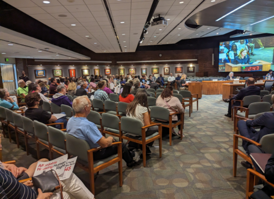
- Attend a Planning Board meeting
- Attend a Design Advisory Panel meeting
- Attend a Historic Preservation Commission meeting
- Attend a Cemetery Preservation Board meeting
- Attend an Administrative Adjustment hearing
- Attend a Temporary Use hearing
- Attend a Nonconforming Use Confirmation hearing
- Learn more about the County's new General Plan
- Learn more about PlanHoward Academy
Stay in Touch
Subscribe to the DPZ Digest!
Sign up for the DPZ Digest newsletter to receive the latest news about the department's planning initiatives and programs.
To read earlier editions of the newsletter, click here.


